Contact Us / Getting Here
Rates

Fishing:
Walleye
Muskie
Northern Pike
Smallmouth Bass

Lake Maps:
Map of Lac Seul
Satellite Photo of Lac Seul

Lodge & Cabins:
General Camp Information
Cabins
Facilities
Boats & Motors
Bait, Tackle & Store
Camp & Guest Photos

Photos & Videos:
Walleye Photos
Muskie Photos
Northern Pike Photos
Smallmouth Bass Photos

Outdoor Help & Trip Info:
Trip Preparation
Regulations
Ontario Outdoor Card
Passport Requirements
Family & Kid's Activities

Fishing Tactics & Best Lures:
Walleye Fishing Tips
Muskie Fishing Tips
Northern Pike Fishing Tips
Smallmouth Bass Fishing Tips

Resources & Tips:
How to Fillet Walleye
Great Ways to Cook Walleye
Walleye Weight Calculator
How to Clean Pike
Muskie & Pike Weight Calculator
Muskie/Pike Difference Chart
Bass Weight Calculator

Trip Details:
F.A.Q.
Links
Camp Newsletter

Home


Our Fishing Newsletter
Email:

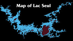
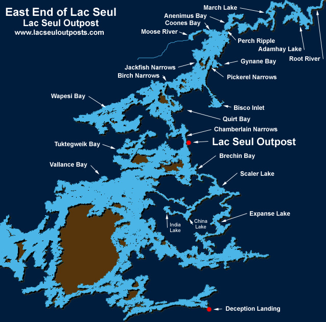
Map of the East End of Lac Seul:

Latitide: 50º 20'N
Longitude: 92º 30'N

Surface Area: 559.7 square Miles
Perimeter: 2,972 miles
Height Above Sea Level (ASL): 1,171 feet
Mean Depth: 23.3 feet
Max Depth: 155 feet

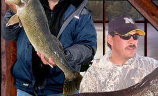
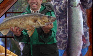
Fish Species: Walleye (Pickerel), Muskie, Northern Pike, Smallmouth Bass, Sauger, Perch, Whitefish

Map of all of Lac Seul
Giant Map of the Lac Seul (.jpg)
Giant Map of the Lac Seul (.pdf - you can zoom in & out with .pdf)
Satellite Photo of Lac Seul